

Sun and shadow simulator · free
See where the shade falls on your plot
Enter an address and watch in 3D how the sun and the shadows of neighbouring houses, trees and hills move during the day. Any day of the year, from the laser scan of Slovenia.
Address, parcel or building
or pick on the map · see an example
- Free, no account
- Neighbouring houses, trees and hills
- Hours of sun for every m² of the plot
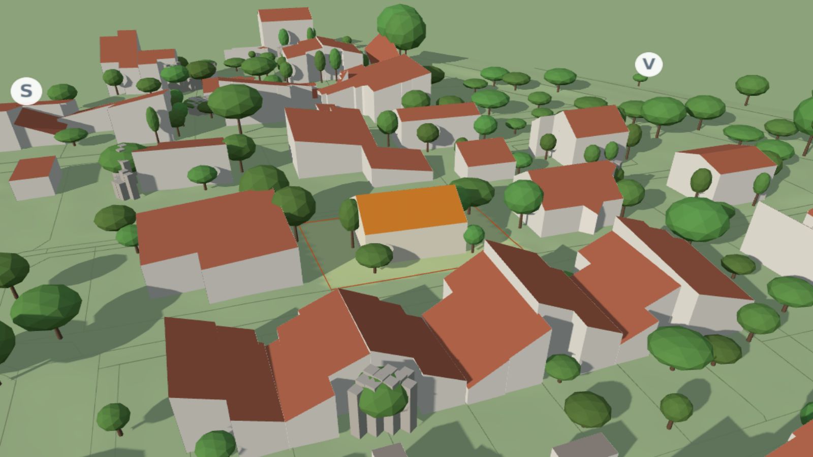
The same house in December and June
Drag the slider. At noon on 21 December the sun is low and the neighbouring houses shade almost the whole garden. At noon on 21 June the garden is all in the sun.
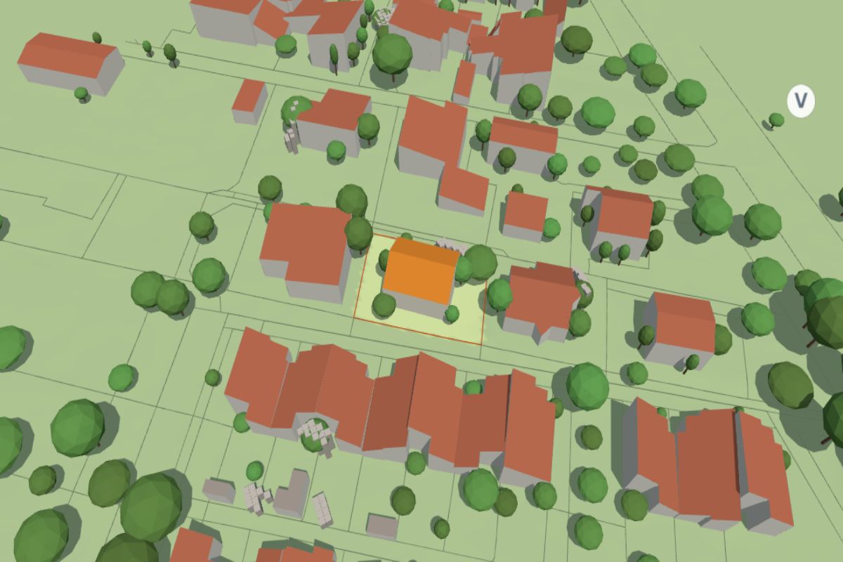
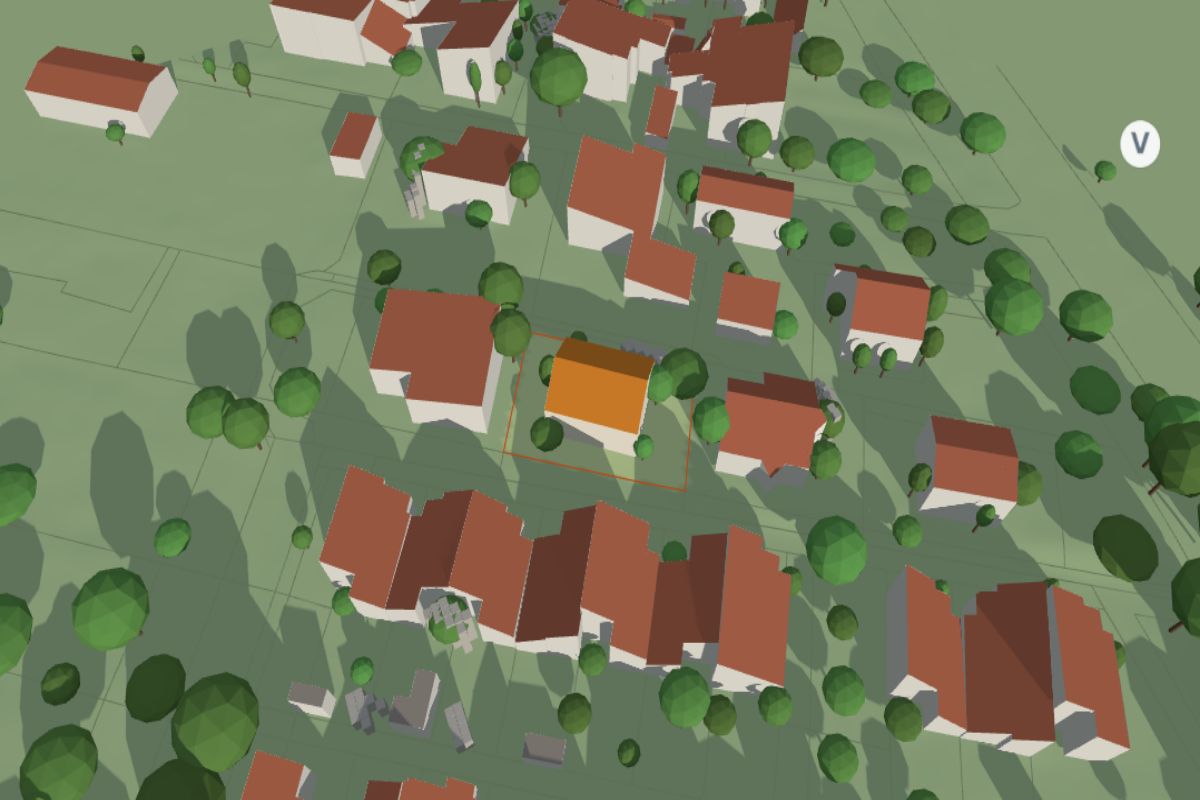
21 December, noon
21 June, noon
Example: a house in Ljubljana. Buildings and trees from the 2014–2016 laser scan.
What you see
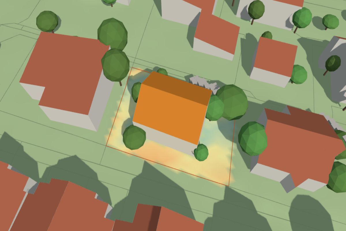
The shade at every hour
Play the day from sunrise to sunset or move the slider to the hour you care about.
Any date
Quick buttons for the shortest and longest day and the equinox, or pick your own date.
Hours of sun on the plot
A colour map shows how many hours of direct sun each square metre gets on the chosen day.
Hills and forest on the horizon
When the sun sets behind a hill or a forest the plot is in shade, even if the hill is kilometres away.
How the simulator works
- Enter an address or a plot or click on the map. A click on a roof picks the building, a click beside it the plot.
- We build the surroundings from the laser scan and the cadastre: terrain, neighbouring buildings with their roof shapes, trees and plot boundaries up to about 90 m away.
- Pick a date and play the day. You see where the shade falls at every hour, how much of the plot is in the sun and how many hours of sun each square metre gets.
Try an example
Open the simulator at one of these places and play the day.
A house in Ljubljana
A garden between neighbouring houses: almost all in shade at noon in winter, all in the sun in summer.
Open in the simulator →Blocks of flats in Fužine
How long the shadows of the blocks are in winter and how much sun the lawns between them get.
Open in the simulator →A plot in Kranjska Gora
High mountains to the south: in winter the sun clears the ridge late and sets early.
Open in the simulator →
Simulator
Pick a house or a plot. The 3D view opens below.
Address, parcel or building
The 3D view of the chosen house or plot and its surroundings opens here.
Who it is for
House and plot buyers
Before buying, see whether the garden sits in the shade of a neighbouring block or forest in winter.
Builders and architects
Where to put the terrace, the living-room windows or the garden before the house is drawn.
Owners
How much sun the garden, balcony or roof really gets, and when it loses it.
Frequently asked questions
Where do the buildings and trees come from?
From the national laser scan of Slovenia (ARSO, flown 2014–2016) and the GURS cadastre. Building and plot outlines come from the cadastre, heights, roof shapes and trees from the scan. Roofs are drawn as simple shapes (flat, single pitch, gable, hip) fitted to the measured heights.
What about houses built after 2016?
Buildings the scan does not hold yet are drawn as blocks with the height from the building register (grey roofs). They will be replaced once the 2023–2025 scan is available.
Are hills taken into account?
Yes. The surroundings up to about 90 m are in 3D; buildings and forest up to about 170 m count as the horizon, and distant hills come from the PVGIS terrain horizon (European Commission). Once the sun sets behind a hill, the whole scene is in shade.
Why are trees too dark in winter?
The scan does not tell deciduous trees from conifers, so all trees are shown in leaf all year. Deciduous trees cast weaker shadows in winter. You can switch the trees off and compare.
Is the simulator free?
Yes, with no account and no limit. For the electricity a solar plant on the roof would produce, use the Solar panel potential tool.
See the sun on your plot
Pick a house or a plot and within seconds see where the shade falls at any hour.
Open the simulatorOpen the simulatorOpen the simulatorHow it works