

Srebrni gaj
under constructioncompletion 2026verified 10 Sept 2026
Dolenjske Toplice
Developer: GH Holding
Key facts
About the development
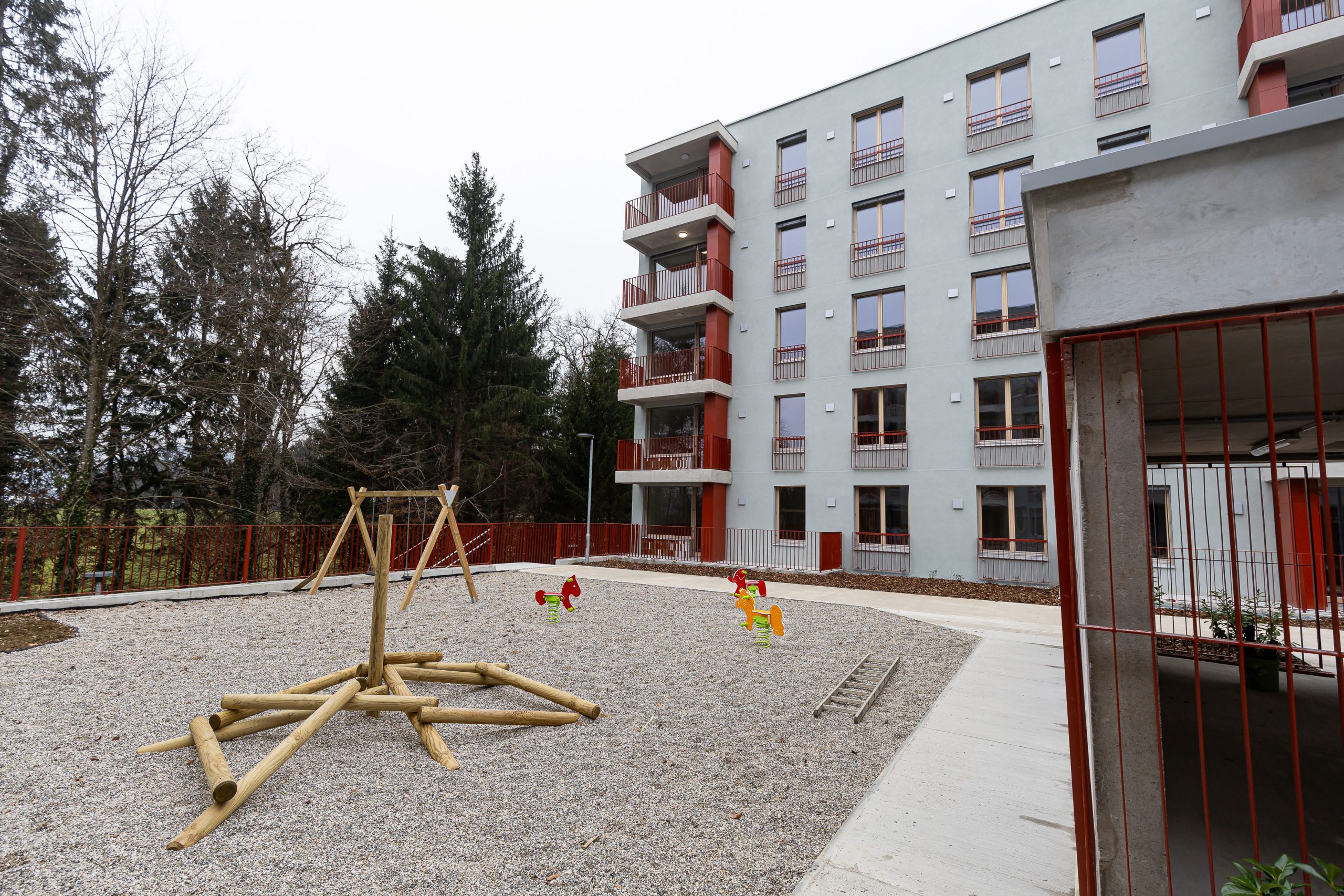
GH Holding gradi stanovanjski kompleks Srebrni gaj v Dolenjskih Toplicah s 53 stanovanji v osrednjem objektu in 28 enostanovanjskimi hišami kot nadgradnjo projekta Vitalis; zaključek je predviden konec leta 2026.
How it has moved
- planned
- presale
- under construction
- for sale
- last units
- sold out
- completed
Follow this development
We will write to you when its status, starting price or number of available units changes. Free, and you can switch it off at any time.
A free analysis of this location
Check the plot, the prices achieved nearby, flood and landslide exposure and the seismic zone. No sign-up needed.
Sales on the plots and in the buildings
No sale has been recorded on these plots, or in the buildings on them, yet, which is what a development not yet entered in the register looks like.
Deals around the site
Median price by year
| Year | Median | Sales |
|---|---|---|
| 2,026 | 1,242 €/m² | 1 |
| 2,025 | 2,368 €/m² | 1 |
| 2,022 | 430 €/m² | 1 |
| Date | Type | Area | Amount | €/m² | New build | Distance |
|---|---|---|---|---|---|---|
| 12 May 2026 | House | 106 m² | €450,000 | 1,242 | 200 m | |
| 19 Dec 2025 | Apartment | 43 m² | €108,000 | 2,368 | 260 m | |
| 3 Oct 2024 | Apartment | 56 m² | €69,000 | 110 m | ||
| 19 Sept 2022 | House | 175 m² | sign in | 290 m | ||
| 24 May 2022 | House | 106 m² | sign in | 100 m | ||
| 14 Sept 2021 | House | 71 m² | sign in | 270 m | ||
| 30 Jul 2021 | Apartment | 3 m² | sign in | 260 m | ||
| 30 Jul 2021 | Apartment | 11 m² | sign in | 260 m | ||
| 30 Jul 2021 | Apartment | 11 m² | sign in | 260 m | ||
| 10 May 2021 | Apartment | 48 m² | sign in | 260 m |
8 more recorded deals are locked. Signing in unlocks them.
Flats and houses sold on the open market in the last 6 years, within 300 m of the development. From the property transaction register (ETN, GURS).
Cadastre
Plot
- 860/10 on the mapcadastral community 1495 TOPLICE · 260 m²
- 860/9 on the mapcadastral community 1495 TOPLICE · 204 m²
- 860/8 on the mapcadastral community 1495 TOPLICE · 220 m²
- 860/4 on the mapcadastral community 1495 TOPLICE · 229 m²
- 860/3 on the mapcadastral community 1495 TOPLICE · 231 m²
- 860/5 on the mapcadastral community 1495 TOPLICE · 229 m²
- 860/6 on the mapcadastral community 1495 TOPLICE · 229 m²
- 860/7 on the mapcadastral community 1495 TOPLICE · 230 m²
- 860/2 on the mapcadastral community 1495 TOPLICE · 3,307 m²
- 860/16 on the mapcadastral community 1495 TOPLICE · 249 m²
- 860/14 on the mapcadastral community 1495 TOPLICE · 200 m²
- 860/13 on the mapcadastral community 1495 TOPLICE · 194 m²
Building
- 1495-907on parcel 860/10 · Year built: 2026 · Floors: 2 · Dwellings: 1
- 1495-906on parcel 860/9 · Year built: 2026 · Floors: 2 · Dwellings: 1
- 1495-905on parcel 860/8 · Year built: 2026 · Floors: 2 · Dwellings: 1
- 1495-901on parcel 860/4 · Year built: 2026 · Floors: 2 · Dwellings: 1
- 1495-900on parcel 860/3 · Year built: 2026 · Floors: 2 · Dwellings: 1
- 1495-902on parcel 860/5 · Year built: 2026 · Floors: 2 · Dwellings: 1
Satellite image
Spatial plan
- Občinski prostorski načrt Občine Dolenjske Toplice Official record on the mapAdopted · In force · adopted 29 Oct 2009 · in force from 11 Nov 2009 · area 11,014.6 ha
- Tehnična posodobitev grafičnega prikaza namenske rabe prostora občinskega prostorskega načrta Občine Dolenjske Toplice Official record on the mapAdopted · In force · adopted 18 Dec 2025 · in force from 31 Dec 2025 · area 11,011.2 ha
- Spremembe in dopolnitve Občinskega prostorskega načrta Občine Dolenjske Toplice (SD OPN 4) – kratek postopek Official record on the mapAdopted · In force · adopted 14 May 2025 · in force from 31 May 2025 · area 11,014.8 ha
- Spremembe in dopolnitve občinskega prostorskega načrta Občine Dolenjske Toplice – SD OPN 2 Official record on the mapAdopted · In force · adopted 27 Mar 2024 · in force from 6 Apr 2024 · area 11,018.9 ha
Land use
- PC Površine, namenjene cestnemu prometuPlanning unit (EUP): DT-PC · Detailed plan (OPPN) required: no · Source: Tehnična posodobitev grafičnega prikaza namenske rabe prostora občinskega prostorskega načrta Občine Dolenjske Toplice, in force from 31 Dec 2025
From the register of spatial acts (MNVP). The official text and drawings are on the act's own page in the spatial information system.
Building permits and construction starts
| Date | Act | Procedure | Administrative unit | Distance | |
|---|---|---|---|---|---|
| 10 Mar 2026 | Building permit | Sprememba in dopolnitev gradbenega dovoljenja | Upravna enota Novo mesto | 50 m | on the map |
| 27 Sept 2024 | Building permit | Gradbeno dovoljenje | Upravna enota Novo mesto | 80 m | on the map |
| 5 Sept 2024 | Building permit | Gradbeno dovoljenje | Upravna enota Novo mesto | 50 m | on the map |
From the register of administrative acts (MNVP). Acts filed on the development's own buildings and within 150 m of it. The register publishes no unit count on an act.
The neighbourhood
Warnings and constraints
- no kindergarten or school nearby
- landslide-prone area
- outside flood-hazard areas
- elevated seismic hazard (0.25 g)
Public registers
- PISO: spatial plans for Dolenjske Toplicegeoprostor.net
- GURS: public cadastre vieweripi.eprostor.gov.si
- ARSO: environment atlasgis.arso.gov.si
- DRSV: water atlasgeohub.gov.si
The municipality in numbers
Population, wages, sales and prices for Dolenjske Toplice.
Links
Website
Sources
Similar developments nearby
Something missing or wrong?
We keep this entry by hand. Report a figure that does not hold or, if you are the developer, fill in what is missing.